
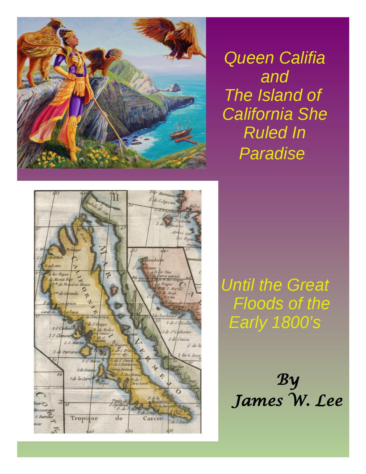
(make sure to check out the fearful Newton top right)
~ Hat tip to Thegeocentricgnostic.com
In September 1905, Dowie suffered a stroke and recuperated in Jamaica, claiming $2,000 a month expenses from the investments, and asked Voliva to return to oversee the city in his absence.[2] Voliva arrived in February 1906, whereupon the congregation revolted against Dowie’s leadership accusing him of corruption and polygamy and elected Voliva as head of the church, which he then renamed to the “Christian Catholic Apostolic Church.” By careful management he rescued Zion from bankruptcy gaining the support of the church members. He kept tight control on his some 6,000 followers, which made up the community, even up to the point of dictating their choice of marriage partners. The city of Zion was effectively controlled by the church; all of its real estate, while sold at market rates, was conveyed under an 1,100 year lease, subject to many restrictions and subject to termination at the whim of the General Overseer. Religions other than the Christian Catholic Apostolic Church were effectively banned – visiting preachers from rival sects were harassed and hounded out of town by the city police force.
Voliva diversified Zion Industries, an industrial concern owned by the church that manufactured Scottish lace, to include a bakery which produced the popular Zion brand fig bar cookies and White Dove chocolates. Zion was a one-company town and its workers were paid substandard wages.
He introduced many new rules for members and notices were placed around the town with stern warnings that the independents (who didn’t belong to the church) resented and often burned. But the city was established as a safe space for those within its boundaries.[3]
From 1914, he gained nationwide notoriety by his vigorous advocacy of flat earth doctrine. He offered a widely publicized $5000 challenge for anyone to disprove flat earth theory.[4] The church schools in Zion taught the flat earth doctrine. In 1923 he became the first evangelical preacher in the world to own his own radio station, which could be heard as far away as Australia. His radio station broadcast his diatribes against round earth astronomy, and the evils of evolution. He was quoted about the sun as follows:
The idea of a sun millions of miles in diameter and 91,000,000 miles away is silly. The sun is only 32 miles across and not more than 3,000 miles from the earth. It stands to reason it must be so. God made the sun to light the earth, and therefore must have placed it close to the task it was designed to do. What would you think of a man who built a house in Zion and put the lamp to light it in Kenosha, Wisconsin?[4]
He became increasingly focused on destroying the ‘trinity of evils’: modern astronomy, evolution and higher criticism, insisting on a strict interpretation of 24-hour days for creation. source

Wilbur Glen Voliva a successor to John Alexander Dowie, the other day brushed aside all the findings of science with regard to the formation of the earth. According to Mr. Voliva, the sky is a vast dome of solid material from which the sun, moon and stars are hung like chandeliers over a flat world. The edge of the dome, he explains rests on a wall of ice which surrounds the flat earth to keep foolhardy mariners from tumbling off. Also Mr. Voliva announced that the sun is a small body about forty miles in diameter and about 3,000 miles from the earth. Existence of a flat-earth has been taught in the Zion schools for a considerable time. Mr. Voliva merely cleared up these details to set at rest any inquiries among any unduly curious pupils or their parents.
(more)


Recent Comments